The chances of getting a clear, warm Saturday to summit Mt. Washington are slim. There might be four or six such Saturdays the entire year, as this tall peak makes its own weather (home to the world's worst weather and insanely fierce winds). Clouds can blow in in an instant, leaving you unable to see your hand in front of your face. Alpine hiking is of course inherently dangerous, but at this point, we had prepared for just about everything.
Two days before our hike, we made the decision to take the Ammonoosuc Ravine Trail, which begins near the Cog Railway on the mountain's western flank (Crawford Notch side, not the Pinkham Notch/Tuckerman's Ravine side). This trail ends at the AMC Lakes of the Clouds hut, nestled snugly in between Mt. Monroe and Mt. Washington, connected via the Crawford Path. It would be about 10 miles round-trip, but with the most elevation gain I've endured yet: ~4,500 ft. of elevation gain.
We awoke super early on Saturday, checked the Observatory forecast: clear and 50, with the wind chill in the 30s. Winter hat and mittens, check. Thermal long underwear, check. Fleece and raingear, check. PLENTY of water and food, check.

 We had an auspicious beginning to the day, when we were on Rte. 302 near Bretton Woods...a big bull moose by the side of the road!

 We parked near the railway and began. The trail starts out nicely enough, lulling you into believing that it won't be so bad. Dogs were happy to be in the woods running around, and so were we.


 The river flows through the woods, with piles downed trees the evidence of winter's harshness on the flora. Were they pushed there from a river swollen with snowmelt? An avalanche? Perhaps a vicious ice storm followed by heavy snow, or one of the few major wind storms we've had earlier this year.
 We were sharing the trail with a number of groups and individuals, and once the trail turned into a neverending stairmaster of granite rocks, the people lined up like ants to ascend.


 Up, up, up, and up...the canopy opened up for views of the waterfalls we were about to climb up (slick vertical granite with very few hand- and footholds, yikes!) and also of the Cog Railway making its first trip up the mountain. We were doing it the old-fashioned way. Zoe and Shelby looked like mountain goats bounding up tall sections of rockface with little place for their paws.


 We met a few cool folks on the trail, including a couple of native Pennsylvanians and Peter from NYC. We took a break at the AMC hut to take in the stunning views. The dogs were doing really well, thanks to the physical conditioning we've been doing and the coolness of the mountain air. Mt. Monroe on one side of the hut.


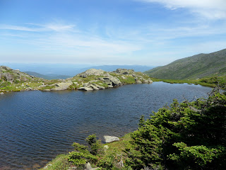 Only a couple more miles to go up to hit Washington...it looked like it was sooo close, just within reach, our goal for the summer. But it's a HUGE mountain, and looks are deceiving. We picked our way among boulders and millions of loose rocks, continuing our ascent to the peak. My legs were running out of energy, as I had blasted through my breakfast calories miles before. I was in need of my PB&Js at the top to regain some strength.


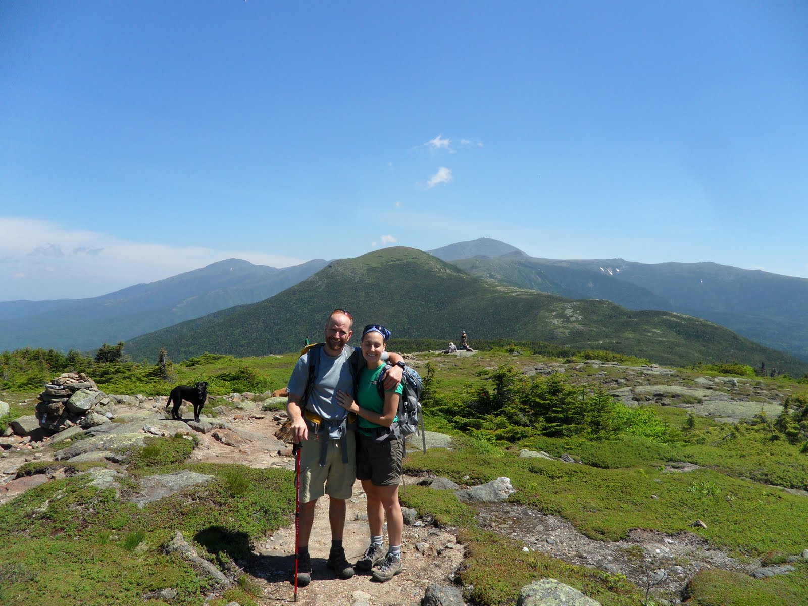
 Another breathtaking view of the "northern Smokies," as I call them. The presidential peaks that go on and on, the White Mountains a lovely smear of jagged and rounded blues as far as the eye could see. No sign of clouds, we were lucky. It began to get colder and we put on more layers. One last break along the way and finally! We had summitted the highest peak in the Northeast!! 6,288 ft. Boy, it was chilly up there...


 The unfortunate part is that the hike down was by far the toughest part of the climb.


 Spending 10% or more going down a mountain on your butt because it's essentially a granite rock face for a waterfall nearby is not the most pleasant experience. (Hey, I'm klutzy, okay?) My knees felt like knives were slicing through the patellas with every step, my muscles too tired to bear the brunt of the impact, and my legs began locking into place rather than flexing. It was a very slow, painful, and frustrating descent for me. I bit back tears for most of the way until two elderly, very overweight men passed us. How could they be doing so well on this trail, when someone who is much younger and fitter was in so much pain? The tears began in earnest, despite knowing we were in the home stretch.
 FINALLY! We got to the car, now super hot in the sun. Air conditioning at full-blast, hiking boots and sweaty clothes off, time for the long ride back and looking forward to sleeping like a rock after our hard word.
In my quest to shape up to hike Mt. Washington this summer, we have been getting up into some much higher altitudes. Our last one, summiting Mt. Eisenhower, allowed us to view the surroundings at ~4,700 ft. Mt. Washington is over 6,000 ft.
Alpine conditions can change on a dime and hikers need to be uber-prepared for any weather, regardless of season. The Mt. Washington Observatory offers camera shots so you can see if it's cloudy or clear, and they also give a detailed weather forecast for the current day and the next for the higher elevations (including some of the presidentials).
So we will be hiking Mt. Monroe in two days, hopefully hopping over to Lakes of the Clouds, and perhaps Mt. Washington, depending on how far it is and how we (and our dogs) feel. I just checked the weather on the top of the mountain. Keep in mind, down here, it's in the high 70s to low 80s. On Mt. Washington, on July 1st, it's just above freezing. Tonight the high peaks are likely to get ice. Not just frost, but actual ICE. IN JULY.
....seriously?!
I have a thing for all things archaic. This passion extends most notably into the animal kingdom, with my grand affection for creatures that look unusual and ancient. The way I see it, if an animal looks like it came from the age of the dinosaur, then it must have little need for further evolution. Exceedingly functional.
Case in point -- the fish I love:
1) sturgeon!
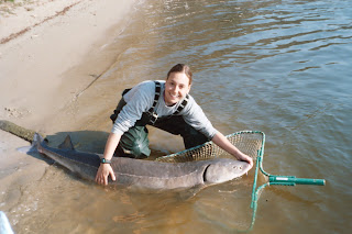
 2) paddlefish (photo to come later)
3) gar

 All primitive in appearance, yet finely tuned to getting the job done just the way they are. Which brings me to my topic today: horseshoe crabs!! What an eccentric little creature. While the media draws a lot of attention to those down in the mid-Atlantic, we happen to have these armored animals crawling around Great Bay in the summer and early fall as well. This is on the way to Adams Point on the bay.
 I was out taking photos with researchers who are studying this curious creature. Jean, the Ph.D. student in charge of the project, is trying to learn how horseshoe crabs impact the "infauna" (organisms living in the mud) of the bay. Estimating the number of crabs that frequent this region is an exercise in futility (although she has tried by snorkeling when the tide is in), so she has to approach this from another angle. She is looking at the number of divots in the mud created by the crabs, and using a camera pulled across a line over the bay (that happens to look like a clothes line when not in use). She examines the video snapshots to estimate the activity going on in the mud.
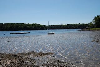
 Jean and the camera line:
 No crabs there right now, they hang out in colder, deeper waters during low tide, and come back up to these spots at high tide. Jean says it's likely there is an abundance of their preferred food here (worms and clams) due to all the evidence of their activity. They can crush clam shells with their "arms" that have a special crushing apparatus, but also their gut functions like a gizzard and does a lot of the hard work to break down the shells.
The most interesting aspect about my morning was watching scientists cross paths. While Jean was telling me about her project, a familiar-looking man walked up to us, covered in mud up to his knees and elbows, and asked her about her research. I realized this guy was Aria, a man whose research I have peripherally written about in the past: he is trying to determine the amount of mercury in our region's estuarine mud and learning how it cycles through the water and sediments.
 As it turns out, when horseshoe crabs dig up the mud to find their food, they are potentially altering nature's way of moving mercury around (and thus, providing different results for this man's research than he is getting at other sites). Both parties agreed to exchange information that would be mutually beneficial to their research results. I love it when science paths collide! The meeting of the minds.
More on Jean's research later when I go back out in the field with her!
 Ah, nothing like hopping into the still-chilly waters of the Seacoast on a super hot and humid day. I am on surf session #3 of the year, and the surf yesterday was better than I anticipated. The sets were rolling in three or five at a time, and I learned that I am not good at telling which wave I need to catch. I also learned that I am in dire need of strengthening the muscles in my arms, shoulders, and upper back, because I couldn't catch the waves in time.
 I still had a grand ol' time paddling around, chickening out on waves that *might* have reached my knees or thighs. I'm still so timid, I think in part because I know how powerful water can be, with rip currents and the rocks along portions of the coastline. But to feel the wave energy pass through your body is an absolutely amazing experience.
Behold, the scenes of a small wave in which the surfer does not paddle fast enough to catch it!
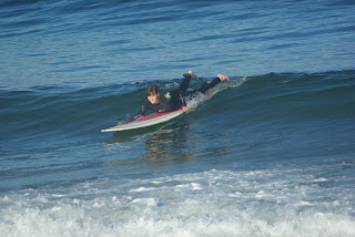
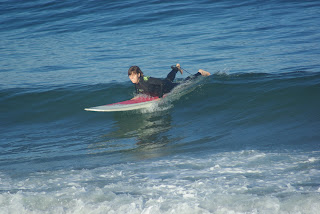
 Time to hit the gym to strengthen the arms...
It was a pretty big weekend for us in terms of our northern excursion. With such a great prediction for the weather--high 80s and sunny--we decided to camp on Friday night and then get an early start on Saturday for a longer hike. I've been choosing the trails thus far, and now it was Jeff's turn to pick. He chose Crawford Path in the Notch starting at route 302.
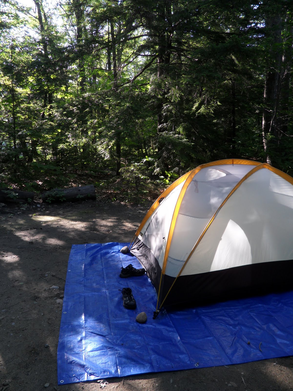
Our campground was within a 15-minute drive of our hike's trailhead. We stayed at the Crawford Notch Campground right on the Saco River. We managed to get a tent site where we had to walk down a path and carry our gear and food in.
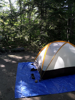 Once there, we hardly saw anyone and had a lovely view of the river. The prospect of a starry sky seen from our tent (without the rain fly) and listening to the river tumbling over small rocks seemed so heavenly. We even had a view of Frankenstein Cliffs from the river, right near Arethusa Falls.
 When we arrived, it was still super hot outside, so we set up our tent and walked along the river. After a yummy camp dinner of fish, veggies and rice, we settled in to watch the fire and the stars. Zoe, as much as she loves to hike and be outdoors, is a downright princess when it comes to her sleeping arrangements. Thus, she hates camping. Look at this pathetic face.
 It got a lot colder than I was predicting, and so it was a loooonnnngggg night without much sleep. It was Shelby's first camping experience and she didn't get any shuteye because she was up listening to all the creatures and valiantly trying to protect the herd inside our tent. In true ninja style, she snuck out of the tent twice through a small opening in the zipper.
Anyway, we wearily climbed out of the tent in the morning, had some oatmeal and set off for our destination: Crawford Path, the oldest continuously hiked trail in the nation. How amazing is that?!
Crawford Path is as long or as short as you want it to be. It ascends Mt. Pierce at ~4,300 ft., continues above treeline along the mountain's spine towards Mt. Eisenhower, Mt. Monroe, and on eventually to Lakes of the Clouds and Mt. Washington. We decided we'd start out and see how we felt. Pretty purple lupine greeted us at the trailhead.
 The dogs were not feeling really well, likely due to stress from camping and weird food, and it was humid and hot, making the ascent more difficult. Plenty of other hiking groups were tackling this trail and we were concerned it would be a steady train of folks up the mountain all day.
 Luckily, we separated from most of them and began our hike. It was a very steady, albeit pretty steep, upward climb. Not quite as ridiculous as Moat Mountain (which is now our measuring stick against which all other trails shall be judged), but there were no breaks, just a constant climb.
 Plenty of waterfalls, rivers running right down the trail, and wet roots and rocks made the climb a bit slick, but nothing this klutz couldn't handle. I actually felt pretty good going up, like maybe my legs were finally in good hiking shape. My heels felt good too, and everything was falling into a nice groove. Most of the trail on Mt. Pierce was in the woods, shading us from the unforgiving sun.
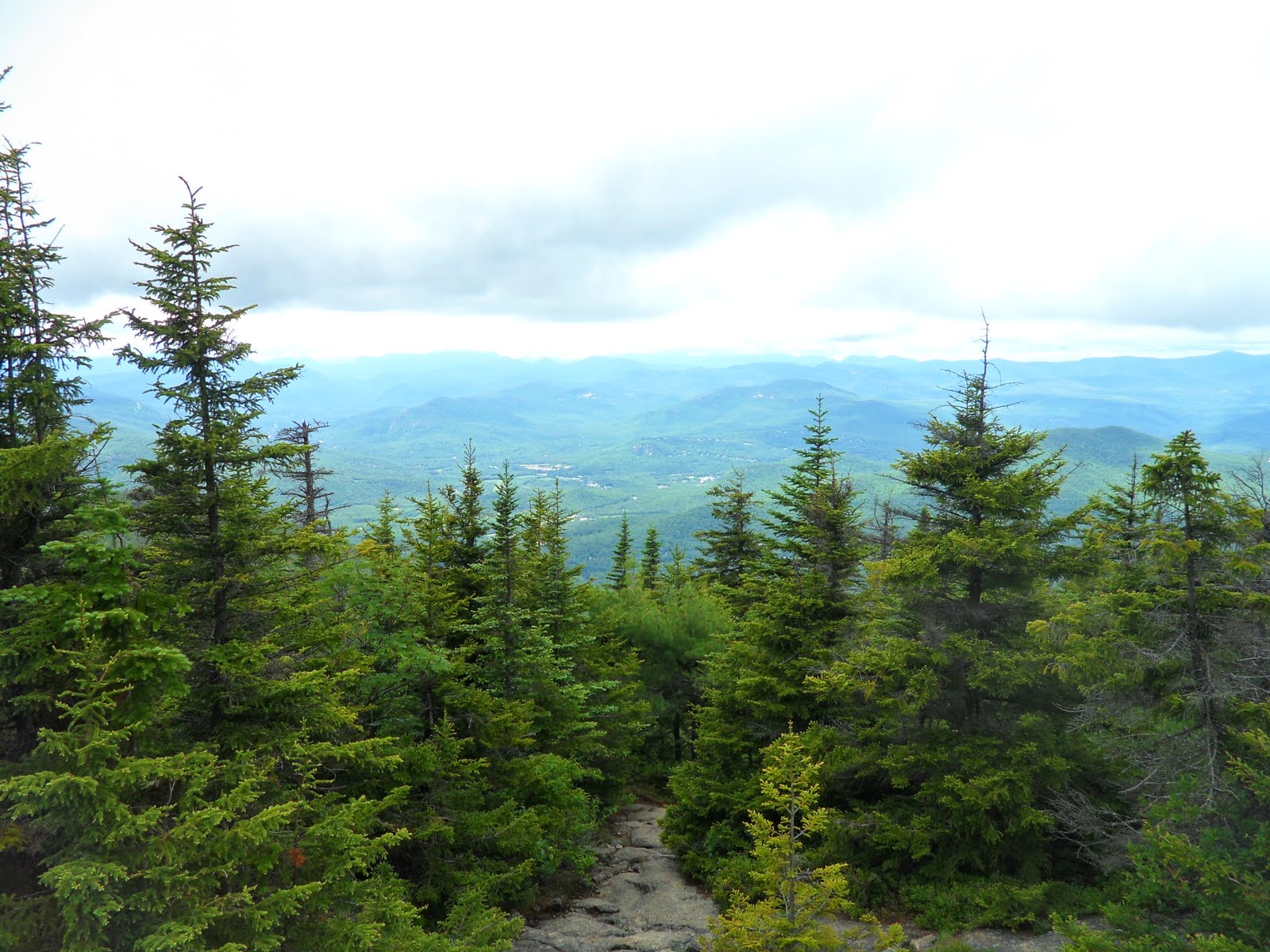
Suddenly we arrived at the treeline edge, and voila!! The views began to unfold. The views were so spectacular, just absolutely stunning.

 The trail wound its way along the ridgelines like the Great Wall of China, and all the tall peaks were at hand. They felt so close, like we might even try for Mt. Washington that day (you can see the observatory on its peak). But being realistic, we figured we'd hit Mt. Eisenhower and see how it went. But first, to enjoy Mt. Pierce! Jeff points for my mom's favorite photo opp.
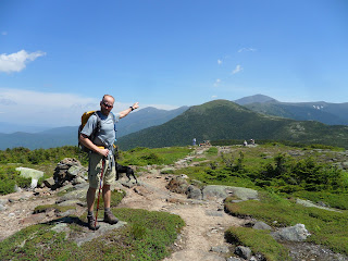
 I love the way the cloud shadows draped over the mountains.
 Mt. Eisenhower laid ahead, but we had to walk on hot rocks and the sun was beating down mercilessly. The dogs were panting and Shelby was burrowing in the alpine shrubs whenever she could to escape the heat. We poured some water over her and Zoe to cool them off, they were real troopers!
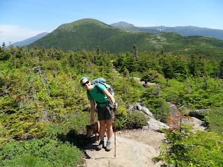
 We heard about some giant swarm of big angry bees at the top of the Mt. Eisenhower cairn, so we hiked up near the top but avoided the tippy top. Instead, we enjoyed the views at ~4,700 ft. So reminiscent of the Smokies but even more spectacular. Some days, I just can't believe I live here and am lucky enough to enjoy this place and what it has to offer.
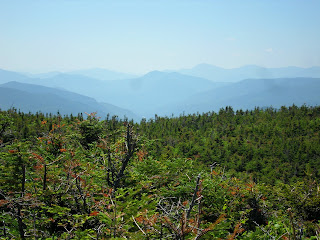
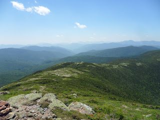 Behold, our goal for this summer, Mt. Washington! So close, but so far...and Tuckerman's Ravine STILL has a bit of snow in it!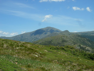
 The long hike down was tough. My knees were screaming at me as much as my calves had been burning going uphill. It felt much longer than the nine miles it actually was. Phew! We were all wiped out from the hike in the heat. The girls fell asleep almost immediately in the cool air conditioned Jeep, and Jeff and I took a quick dunk in the Saco River to wash off the salt, sweat and dirt. We had hiked not one, but TWO presidentials today!!! And amazingly, my legs were not sore the next day. My knees, on the other hand, were not very happy. But the views were incredibly well-worth all the efforts.

Two weekends ago brought more threats of rain, meaning slippery conditions on the exposed granite of the hikes we are trying to conquer. My klutziness is always a factor that has to be accounted for. I am like my grandmother, I will fall for any slight reason, or even none at all. But the thought of going two weeks without a hike meant I would have lost whatever leg strength I have gained in hiking these strenuous peaks.
So we set out on that Sunday, an overcast and humid day, towards North Conway to hit Mt. Kearsarge North (there's also Kearsarge South in western N.H., weirdly enough). Kearsarge North is a little over six miles, and despite the teeny tiny parking area, this trail gets more than its fair share of foot traffic. The promise of a neat fire tower at the top with views all around drew me in.
 And the climb started immediately. This path doesn't waste any time prancing through flat fields for a few miles. Hard-packed earth wound its way up past a pretty little stream and a few cozy cabins. Ahhh, how heavenly! A home amidst the hemlocks. The path revealed millions of tree roots poking up like loops of errant thread from the soil's tightly-fused fabric. Truth be told, I had an even tougher time up this hill from my asthma that kept threatening.
 As the treeline thinned out, we began to see glimpses from across the valley of our last big hike, near Cathedral Ledge and Moat Mountain.
 There is something comforting about looking around and seeing an area with newfound understanding of Place. When you hit a moment where suddenly the geography's puzzle pieces begin to fall into their correct positions and you begin to understand the land. The only location I've ever lived in long enough to fully understand its Place was back in Pennsylvania. This was the first time I felt that New Hampshire really made sense. I could put mountains in proximity of one another in my head and truly understand their existence in relation to one another.
 We passed a few groups of hikers on our way up, and looking around, we noticed that we were about to enter the cloud cover. Cold, misty whiteness blew past us as we approached the top, and despite its short length, this trail had promised my legs would be reminded of their travels the next day. We climbed the stairs to the enclosed fire tower to take a load off and eat some food.
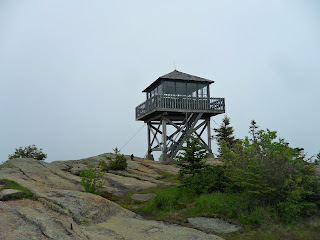
 Not much of a view from within the clouds, but it was a good feeling nonetheless. We chatted with two women, each hiking alone, and began to hike back down. I managed to slip on the wet, exposed granite and fell on my left knee pretty hard, pack flying over my head. Nothing that would stop the progress down the hill, but enough that I felt it the next day. We picked our way carefully and by the time we hit the trailhead and parking lot, my feet were sore and tired but my legs felt pretty good, considering.
Overall, not my favorite hike, but it got the job done as far as keeping my legs and lungs in shape until our next excursion.
Last weekend brought some strong thunderstorms, lots of rain and wind, mixed with supremely humid conditions when it was sunny. We had to skip our weekly hike, sadly, but I found plenty of ways to keep busy.
-Armed with Wild Willy's burgers (veggie with the works for me, yum!), fries and a vanilla milkshake, my honey and I had an impromptu date-night on the rocks by Nubble Lighthouse in York, Maine. Afterwards: saltwater taffy at a quaint Victorian candy shoppe and a walk along Short Sands Beach; hopped on a playground swing and watched the evening fade.
-I tried my hand at bread-making. Herbed focaccia! Oregano, rosemary, sea salt. I clearly need to do more upper arm strengthening because 10 minutes of kneading is really kinda tough! I don't think I let the dough rise for long enough, however, because it came out a bit chewy and dense, like a slightly-stale soft pretzel. Tasty, but definitely not focaccia quality. Those yeast organisms are tough to please.
 -I finally canned the blackberries I picked from the fields outside my farmhouse apartment last year...they have been sitting idly in the freezer, waiting for me. After mashing some of them to extract their jewel-colored juice, I combined the remaining intact berries with the juice, sugar, cinnamon, lemon and framboise (raspberry-flavored liqueur) and canned them. The result: a tasty fruit topping for pound cake, cheesecake or ice cream, and the leftover juices for mixed drinks.
 -More sock knitting. I am beginning to fear this will be The Year of the Sock. I have a few more "orders" which will likely take me right up until Christmas gift-making season. Behold! My first pair, finished a couple months ago, and you can see the color patterns do not exactly match...long story. But they are soft and warm!
 -Despite an on-off relationship with my black thumb, I am trying to cultivate indoor plants. *cry* I am sad about our downtown apartment not having a place for a garden. There is something so soothing about going outside in the sun each day, checking on the plants's progress, watering, pruning, collecting the fruits of my labor and using them for dinner. I will be hitting up the farmer's markets hard this year to can the items I like. But! In the meantime, I am successfully growing a jade plant, technically a succulent. It began as a cutting and a few leaves from my friend's 30-year-old jade. I cut off the dead, woody sections, stuffed them in some potting soil on a south-facing sill, and voila! It is already beginning to grow. It cheers me up, knowing that someday I will own a place with a little garden patch to dig around in. I hope my jade outlasts me.
 -Who knew the water would still be so cold up here? I tried to surf on Monday, but without gloves and booties, I lasted less than 10 minutes. Body core was warm thanks to my awesome new Xcel suit purchased by my man, but hands and feet were numb within minutes. I attempted to get into the ocean and was pushed back on my butt by not one, not two, but three waves (that were pathetically small but somehow still washed over me quite powerfully). After that nasal cleansing, I got back out and sat on the rocks.
 Two women who seemed relatively inexperienced paddled out near me, and I was encouraged to try it again. I got past the break fairly easily and tried to remember what Amie taught me last year. The board is a little too long and the sweet spot is hard for me to find to maintain balance. I was tippy but I tried to move my arms and paddle around--also to find out I have lost most of my upper shoulder and arm strength since last year due to not doing any yoga! I have a lot of catching up to do. Suffice it to say, after about five minutes of paddling, I decided I was too cold and paddled in without catching any waves. Day one for surf 2010 was a "reacquainting" day, I suppose. I still have sand in my ears...but I'm looking forward to getting in the groove and learning lots this year. Nowhere to go but up on the learning curve from where I'm at right now!


 We had an auspicious beginning to the day, when we were on Rte. 302 near Bretton Woods...a big bull moose by the side of the road!
 We parked near the railway and began. The trail starts out nicely enough, lulling you into believing that it won't be so bad. Dogs were happy to be in the woods running around, and so were we.


 Up, up, up, and up...the canopy opened up for views of the waterfalls we were about to climb up (slick vertical granite with very few hand- and footholds, yikes!) and also of the Cog Railway making its first trip up the mountain. We were doing it the old-fashioned way. Zoe and Shelby looked like mountain goats bounding up tall sections of rockface with little place for their paws.


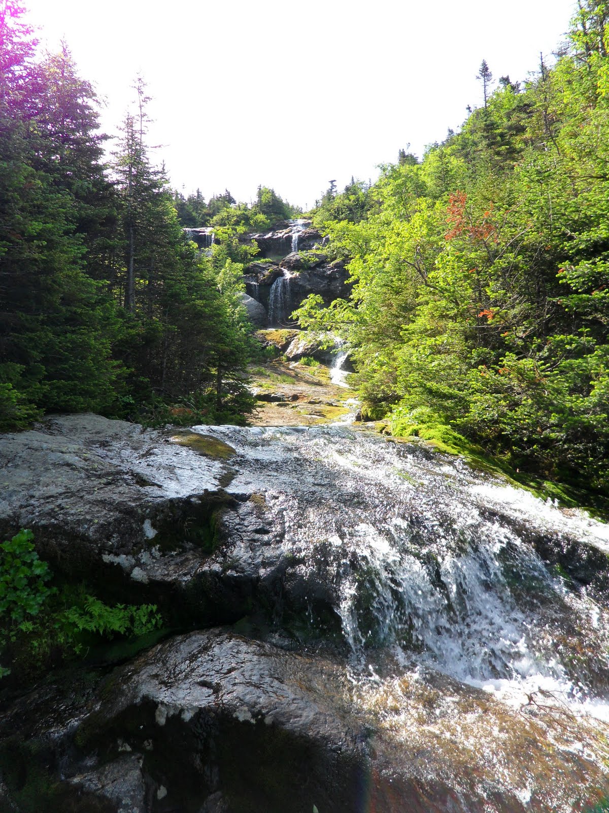


 Spending 10% or more going down a mountain on your butt because it's essentially a granite rock face for a waterfall nearby is not the most pleasant experience. (Hey, I'm klutzy, okay?) My knees felt like knives were slicing through the patellas with every step, my muscles too tired to bear the brunt of the impact, and my legs began locking into place rather than flexing. It was a very slow, painful, and frustrating descent for me. I bit back tears for most of the way until two elderly, very overweight men passed us. How could they be doing so well on this trail, when someone who is much younger and fitter was in so much pain? The tears began in earnest, despite knowing we were in the home stretch.
 FINALLY! We got to the car, now super hot in the sun. Air conditioning at full-blast, hiking boots and sweaty clothes off, time for the long ride back and looking forward to sleeping like a rock after our hard word.